Non Nuoc Cao Bang geopark: what its rocks record, and how to see it from the road
Non Nuoc Cao Bang packs over 500 million years into a road trip. A plain guide to its ancient seas, volcanic rocks and karst, and to reading them from a car.
 Cat Ba Connect4 min read
The short answer
Non Nuoc Cao Bang is a UNESCO Global Geopark whose rocks record more than 500 million years: seabed sediment, fossils, volcanic and intrusive rock, then the limestone towers and caves that make the postcards. You do not need a hammer to read it. From the road, watch for shifts between sharp grey karst and rounder, soil-covered hills, because a change in the slope often signals a change in the rock. Choose one of its four themed routes rather than trying to drive the whole park.
Think of the park as one long sentence
Vietnam News, reporting the geopark’s 2026 certificate in Paris, describes more than 3,683 square kilometres, over 130 geological heritage sites and a history of more than 500 million years. UNESCO first recognised it on 12 April 2018, and it was among those that passed revalidation. A geopark is not a fenced attraction. It is a working region whose geology, culture and livelihoods are told together, so you are in it long before you see a sign.
Read it the way geologists do, as a sequence. Older sea floor at the bottom, life and sediment piling up, volcanic episodes, uplift, and finally rain working on limestone. Each stop on your trip shows you a line from that story, and they are rarely in order.
The seabed under your tyres
Heritage magazine says the area lay under ancient seas hundreds of millions of years ago, and that the park is mostly limestone karst, nearly 2,000 square kilometres of it, showing development from young to mature stages. Limestone like this usually begins as the remains of marine life settling on a sea floor, which is why a mountain pass a long way from today’s coast can be read as old seabed. VNA’s summary lists fossils and ocean sediment among the park’s contents.
Fossil-bearing rock is a reason to keep your hands in your pockets. Do not hammer, pocket or buy specimens. Their scientific value lies largely in where they sit. If you spot a shell-like pattern in a road cutting, take a photograph from a safe place and ask a guide what it is.
When the rock stops being limestone
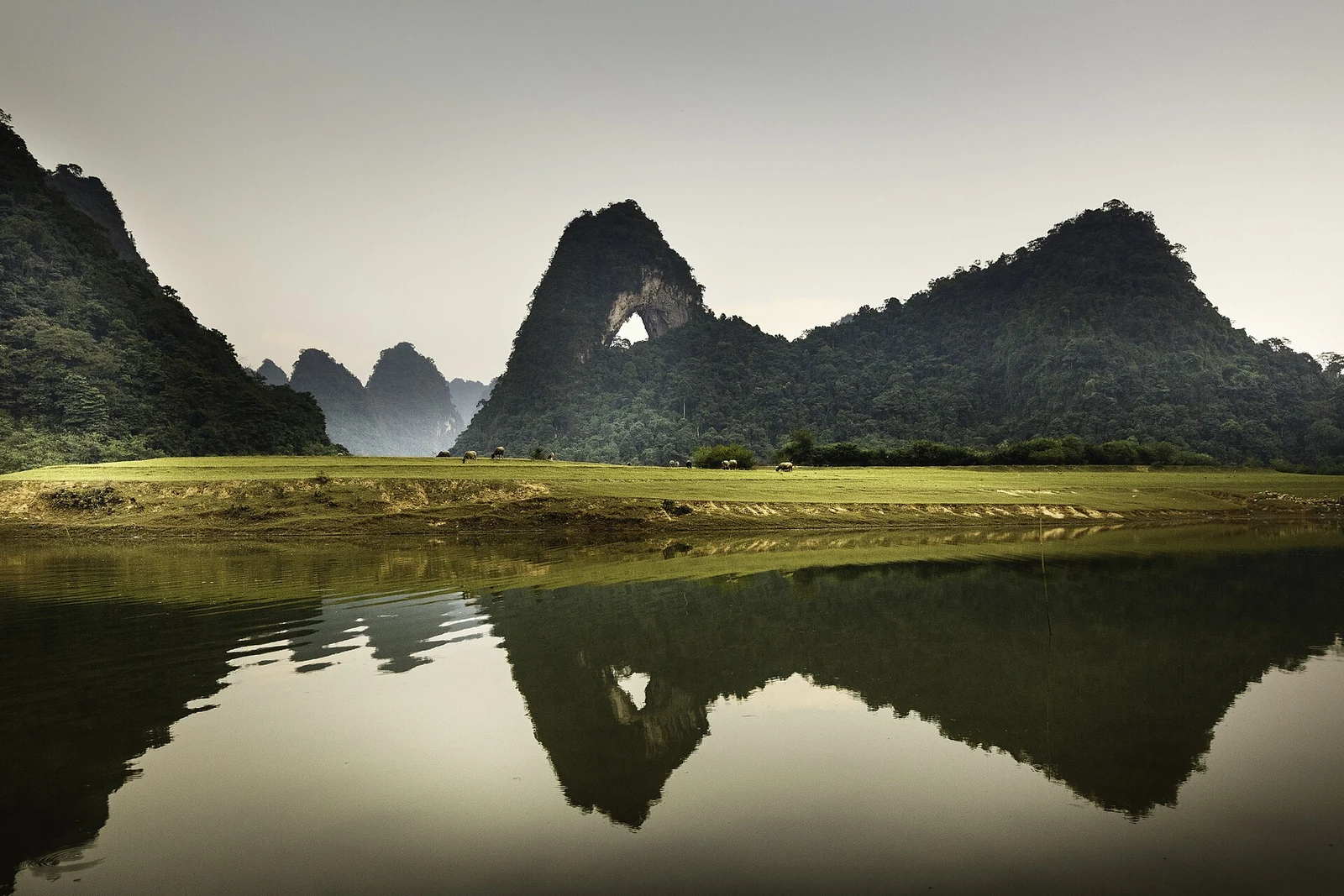
The same Heritage article, in its Vietnamese text, mentions intrusive magmatic and volcanic rocks beside clastic sediments, and VNA’s summary also lists volcanic rocks and minerals. In practical terms, not every hill here is karst. Limestone tends to give sharp towers, bare grey faces and few surface streams, while other rocks usually weather into rounder hills with more soil and more streams. That is a general rule rather than a site-specific reading, so use it as a question for a guide.
The western route is a good place to test the idea. Vietnam News says it focuses on Phia Oac’s forest ecosystems, and the forested heights there feel very different from the karst valleys of the east. Notice how fields, house materials and water change along with the ground. Stone houses at Khuoi Ky village, which the same report cites, show geology turning up in architecture.
Karst, faults and the shape of the eastern road
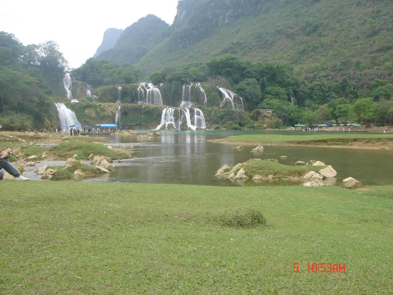
The geopark’s best-known stops are the last chapter. Vietnam News lists karst towers, cone-shaped hills, caves, valleys, rivers and lakes, with Ban Gioc, Nguom Ngao, Mat Than mountain and the Quay Son among its natural sites. Heritage magazine adds that ancient faults helped form the karst, caves and waterfalls, and notes hundreds of explored caves.
From a car window, look for long straight valleys, since faults often create lines of weakness that water follows. Look for a river that vanishes into a hillside or appears from one, and for isolated towers on a flat floor. At a cave, ask why it is at that height. At a waterfall, ask what the rock is doing to the river.
Pick a route, not the whole park
Vietnam News describes four routes with 57 destinations: a northern route around Pac Bo, a western route through Phia Oac, an eastern route with Ban Gioc, Nguom Ngao and Thang Hen, and a southern route on revolutionary history. A fifth, linking to the Dong Van plateau, is in development. Mixing them all in a short trip will reduce the geology to a blur from a seat.
The province is nearly 300 kilometres from Hanoi, across several passes, according to Heritage magazine. Stop only where it is safe to pull over, and use visitor centres or local guides for interpretation; a small panel read in full does more than ten stops of snapshots. Over 95 percent of residents belong to ethnic minority groups, so remember the rock is also home. Ask before entering fields or photographing people.

Questions travellers ask
Is Non Nuoc Cao Bang one attraction with a ticket?
No. It is a large geopark across many communes, and individual sites have their own access arrangements. Check each stop you plan to visit.
Can I collect fossils or rocks as souvenirs?
No. Leave all rocks and fossils where they are. Their value depends on their place in the layers, and removing them damages what the geopark exists to protect.