Fengcong and fenglin: the two landforms behind Ha Long’s island shapes
Two Chinese geology terms explain why Ha Long’s islands look as they do. Learn cones, towers, notches and sea caves so a cruise deck becomes a working field trip.
 Cat Ba Connect4 min read
The short answer
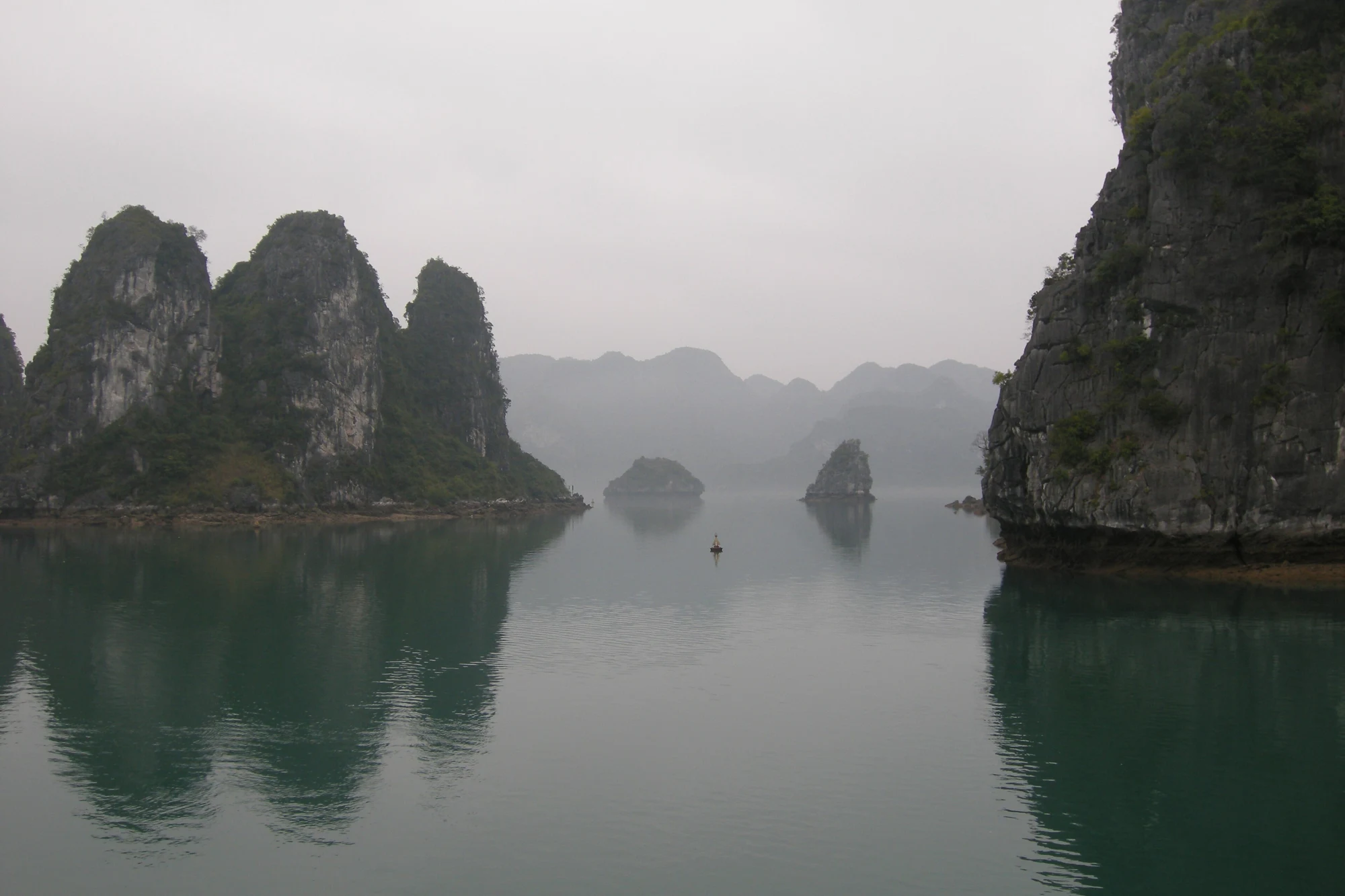
Ha Long’s islands fall into two broad shapes. Fengcong are clusters of cone-shaped hills joined at the base, while fenglin are separate steep towers standing in what is now sea. Both formed on land as tropical karst, then the sea flooded the valleys between them. From a cruise deck, look at whether peaks share a base, then look at the waterline for notches cut by the tide. With those two habits, a long sail between islands stops being scenery and becomes a readable landscape.
A landscape that was built dry
The easiest mistake on a Ha Long cruise is to think the sea made the islands. Geological summaries say otherwise. The IUGS Geoheritage listing describes karst that formed on land and was then repeatedly flooded and reworked as the sea advanced and retreated. Fault-controlled valleys became channels; enclosed depressions became lakes; connected cones became islands, and isolated towers became islets. Imagine draining the bay. You would be standing on a plain among limestone hills, and your boat’s route would be a valley road.
That mental picture is worth more than any island nickname. Dragon and fighting-cock names are a fun layer, but they tell you nothing about why the rock stands where it does.
Cones that hold hands, towers that stand alone
Fengcong translates roughly as “peak cluster” and fenglin as “peak forest”. In practice, the test is the base. Vietnam’s government news portal describes fengcong as groups of cone-shaped peaks, later reshaped by the sea. Wikipedia’s geology summary places them on the larger islands such as Bo Hon and Dau Be, averaging about 100 metres with the tallest over 200.
Fenglin towers look different. They are the steep, separate pillars that make up most of the bay’s smaller islands, roughly 50 to 100 metres tall, with near-vertical walls that keep changing through rockfall. When two island shapes overlap in your view, use the gap between them: see open water running right between the bases, and you are probably looking at fenglin. A continuous ridge with several summits on it suggests fengcong.
Light can trick you. In haze, separate towers stack into what looks like one mass, so check again as the boat turns.
The groove at the waterline
Now drop your eyes. Almost every limestone wall in the bay has a horizontal bite near the water. The government portal notes that notches occur on limestone cliffs worldwide, yet Ha Long’s are exceptionally well developed, and at many sites they extend into arches and caves. Wikipedia attributes them to seawater dissolution and wave erosion. The IUGS page adds that wave action is still forming several levels of them today.
Look for the slightly darker, wet-looking band, and the overhang above it. The tide swings a long way here, with an amplitude Wikipedia gives as 3.5 to 4 metres, so the same notch can look different at breakfast and at lunch. A high notch left above today’s reach is a clue to a former sea level. Ask your guide if they can point one out.
Three caves, three different origins
Cave stops become more interesting when you ask how each one was made. Published summaries recognise three types: old phreatic caves dissolved below a former water table, old foot caves cut by undercutting at a past base level, and marine notch caves formed at sea level. Wikipedia names Sung Sot and Thien Cung as phreatic examples, Trinh Nu as a foot cave and Luon as a notch cave, leading about 50 metres to an enclosed tidal lake.
So a stairway up to a high entrance may be taking you to a cave that formed when the water table sat somewhere else entirely, while a low tunnel you enter by small boat may still be working. Before booking, read which cave your route actually includes, and ask how the tide affects low passages.
Taking the vocabulary on board
You do not need a geology handout. Try this routine for one hour of sailing. Pick an island and sort it: cluster or tower. Find its notch. Look for a cave mouth and guess which type it might be. Then note whether another island repeats the pattern or breaks it. Guesses are fine, since nobody on deck is marking you.
Numbers vary by source. Wikipedia quotes 1,969 islets for the bay, while the management board counts 1,133 limestone islands across the combined Ha Long Bay and Cat Ba heritage area. Treat them as differently defined, not contradictory. Keep off cave formations, and leave rock where it lies, because the features you are learning to read are slow to form and impossible to replace.

Questions travellers ask
What is the difference between fengcong and fenglin?
Fengcong means clusters of cone-shaped hills joined at the base. Fenglin means separate, steep towers. In Ha Long, the plains between towers are now under the sea.
Can I see notches from a large cruise boat?
Often yes, since they run along cliffs at the waterline, though a kayak or small boat brings you closer. Binoculars help from a higher deck, and tide height will change how they look.